
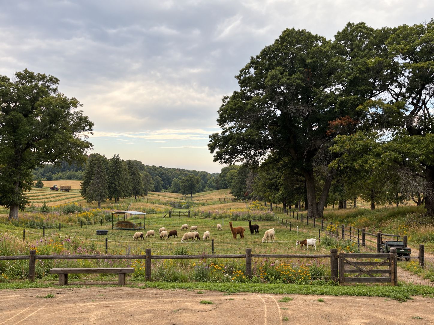
A remembered landscape, thoughtfully carried forward
The Farm of Dreams
A closed golf course above the St. Croix River, reimagined as a conservation-led fiber farm and public gathering place.
Know the ground well. Welcome people early. Let the land guide what comes next.
People + Animals
rhythm · care · belonging
Daily care gives the farm its rhythm—and creates welcome and inclusivity.
Land + Water
soil · prairie · watershed
Soil, prairie, ponds, and watershed guide what the ground can support.
Purpose + Belonging
service · community · care
Education, hospitality, and service make the working farm a shared place.
 Technology
Notice · interpret · plan
Technology
Notice · interpret · plan
Sensors and imagery flag observations; software delivers cited recommendations.
In brief — Executive Summary
A closed course, thoughtfully put back to work
The former St. Croix Valley Golf Course — nine holes above the St. Croix River — thoughtfully transitioned into a conservation-led fiber farm and public gathering place, with a small restorative retreat someday at its center.
The plan keeps the mature trees, the legacy greens, and the open rhythm the course is remembered for. A course walked and cared for since the 1920s carries a century of turf-management history; that long history makes legacy chemicals a meaningful possibility to understand through routine baseline testing. The concept responds with care and good information while keeping the land in community hands.
People are welcome on the land from the start. The farm begins where it makes the most sense — with fiber — while baseline findings and sound farm practice inform the timing and placement of food-growing uses. It is a practical, patient order: know the ground, put it to work thoughtfully, and let each later use arrive in its own time.
The farm is not a funder. It is the foundation — the ground on which community and purpose are built.
Illustrative concept
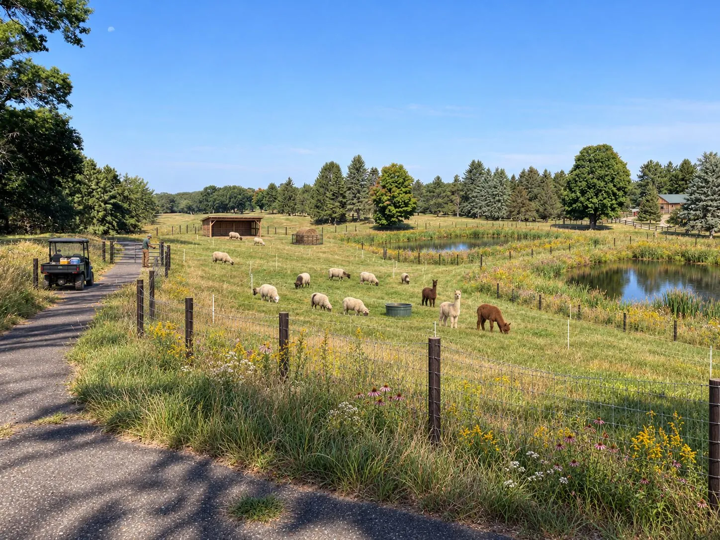
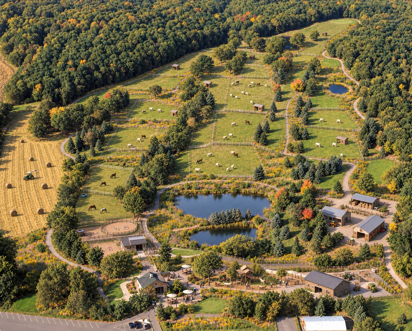
The same ground
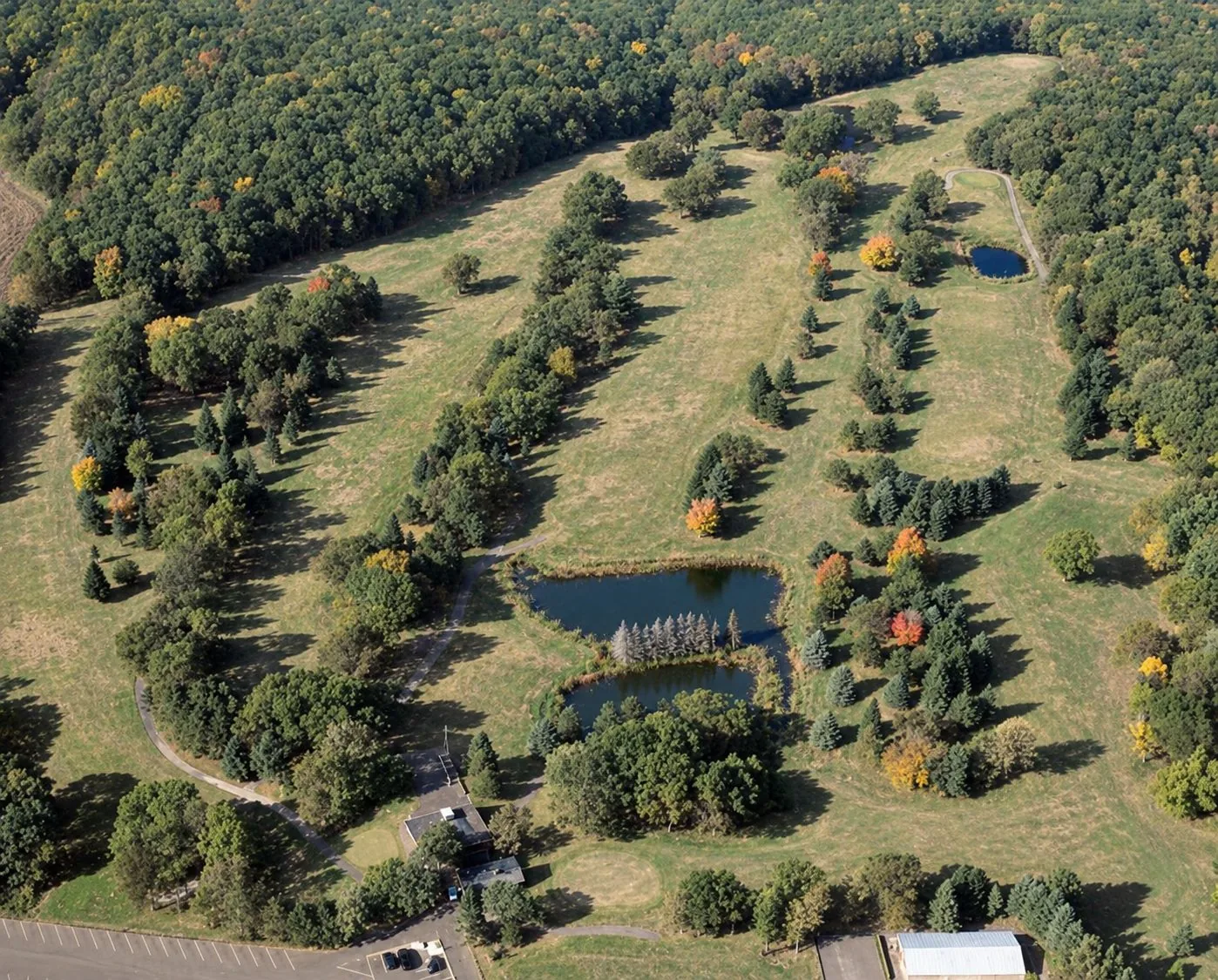
Before & after, overhead
Drag the divider — the land, and the sign in the corner, change with it. The course geometry stays legible: center fairways become primary pasture, roughs return to prairie, and the recognizable open landscape remains.
How it begins
Open early. Grow deliberately.
People can begin enjoying the property while the land is studied and the farm takes shape. Testing and operating readiness determine where — and when — each agricultural use belongs.
Three connected stages
01Knowunderstand the ground
Establish a clear soil-and-water baseline across the former greens, tees, fairways, and rough.
then → let the baseline guide the farm02Beginstewardship and fiber
Restore prairie, strengthen soil and water systems, and establish sheep, alpacas, and fiber goats as the farm’s focused first chapter.
then → expand from a working foundation03Expandwhen the land is ready
Add gardens, apiary, and food hospitality where the evidence supports them. Consider the Bunk House only after the farm, infrastructure, and community are firmly established.
From the start · in parallel
The welcome does not wait
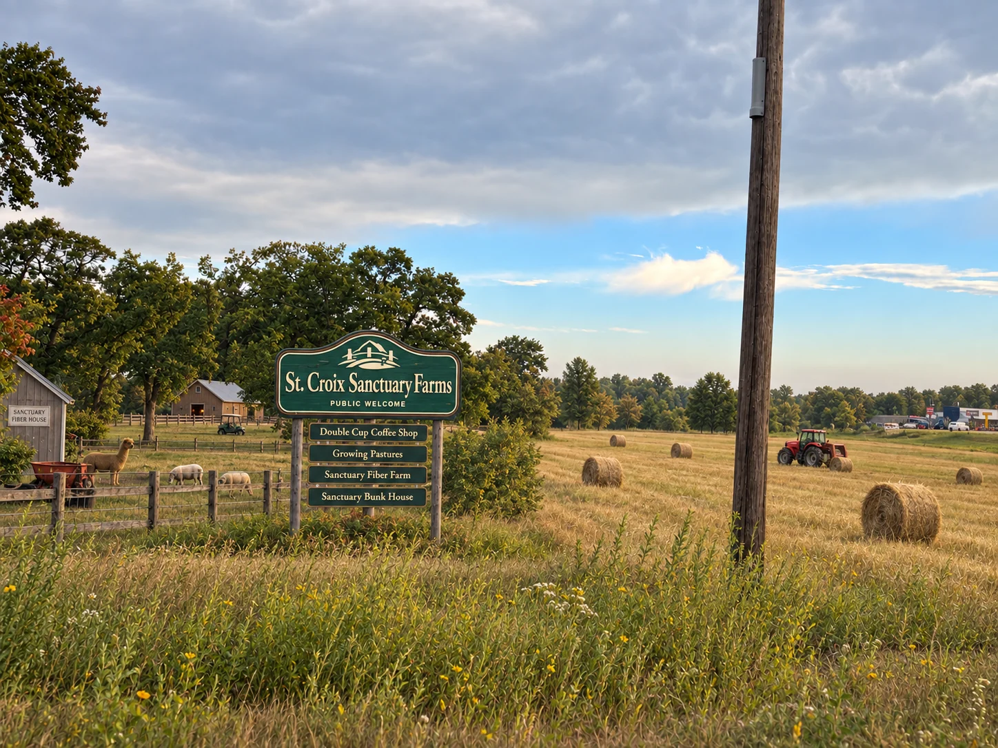
Walking the grounds, legacy-hole fundraisers, horses, the Double Cup coffee cart, and the fiber house can bring people onto the land early.
Illustrative concept
The intelligence layer
Sanctuary Farms Living Systems Lab
AI infrastructure for land, community, and measurable impact
Sanctuary Farms could become a real-world testbed for applied AI: connecting environmental sensors, geospatial data, farm operations, and community participation through computer vision, predictive models, retrieval-grounded agents, and human-approved workflows.
In plain terms: sensors and records feed computer models that watch the land and the operation for change; software agents turn what the models notice into clear, cited recommendations; and a person on the farm decides what actually happens. The system never acts on its own.
How it works — from the ground to a decision
01 · DATASense the land & the work — sensors, imagery, farm records
02 · MODELSNotice what changed — erosion, pasture stress, an off-pattern day
03 · RAGCheck it against the farm’s approved rulebook — and cite the source
04 · AGENTDraft a recommendation with its evidence and confidence
05 · HUMANA person decides — nothing touches animals, land, or money without approval
06 · LOOPMeasure the result — it flows back and the system sharpens
A quick example
Heavy rain is forecast. The system checks slope, soil moisture, and where the animals are, flags one at-risk paddock, and recommends holding the herd back and inspecting the downstream buffer — with its sources and confidence attached. The farm operator approves; later readings show whether it helped.
The four words, in plain English
Model
Software trained to spot one kind of pattern — “is this pasture recovering?” It estimates; it doesn’t decide.
Agent
Software that uses those models to do a small job end to end — gather the facts, draft a recommendation, open a task — then stops for human approval.
RAG · grounded answers
Before it answers, it retrieves the farm’s own approved documents and data and answers from those, with citations — not from general guesswork.
The decision harness
The guardrails: how sure it must be before it speaks, what it may do alone (analyze and recommend — never act), and a log of every recommendation and decision.
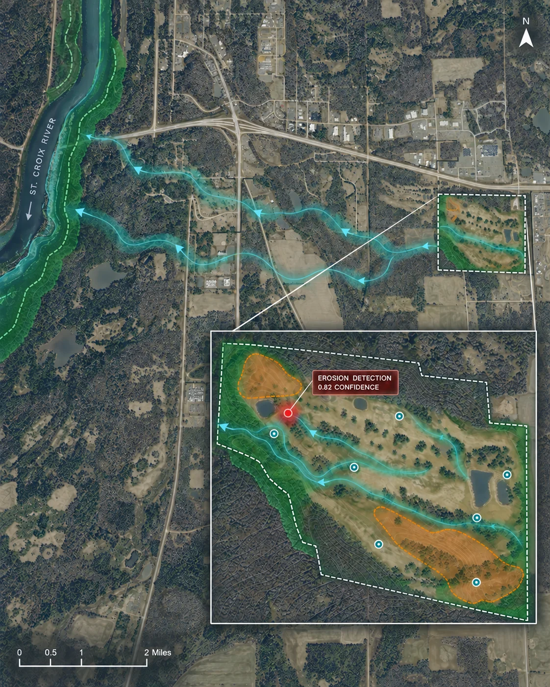
Property digital twin · St. Croix reachIllustrative · not live data
Where it shows up
Land & water
Conservation intelligence
Catch erosion, runoff, and pasture stress early from sensors and imagery — and document what’s working for conservation partners. Detailed in Plate III.
COMPUTER VISION · GEOSPATIAL MODELS · TIME-SERIES FORECASTING
Operations & reporting
Impact intelligence
Turn operating data from across the entities into live dashboards, grant and donor reporting, and long-term measures of ecological and community impact. Detailed in Plate V.
RAG · AGENTIC REPORTING · MULTI-ENTITY DATA SYNTHESIS
Gathering & belonging
Connection intelligence
See which invitations, spaces, and programs bring people back — cohorts only, never individual profiles. Explored on the Double Cup Coffee Co. project page.
PRIVACY-PROTECTED ANALYTICS · COHORT PATTERNS · HUMAN REVIEW
One farm. Two living systems.
The Lab would examine the natural ecosystem of land and water alongside the human ecosystem of gathering and belonging. The full architecture — data, models, grounded agents, and the evaluation harness — is laid out in the appendix.
AI is not the experience at Sanctuary Farms. It is the intelligence layer behind it: sensing change, finding patterns, coordinating action, and proving impact.
Appendix
The fuller almanac — read more if you want
The summary above is the whole idea in brief. Everything below is the detail behind it: the farm, the front door, the structure and its numbers, the mission, and the hands we’re looking for. Open what interests you.
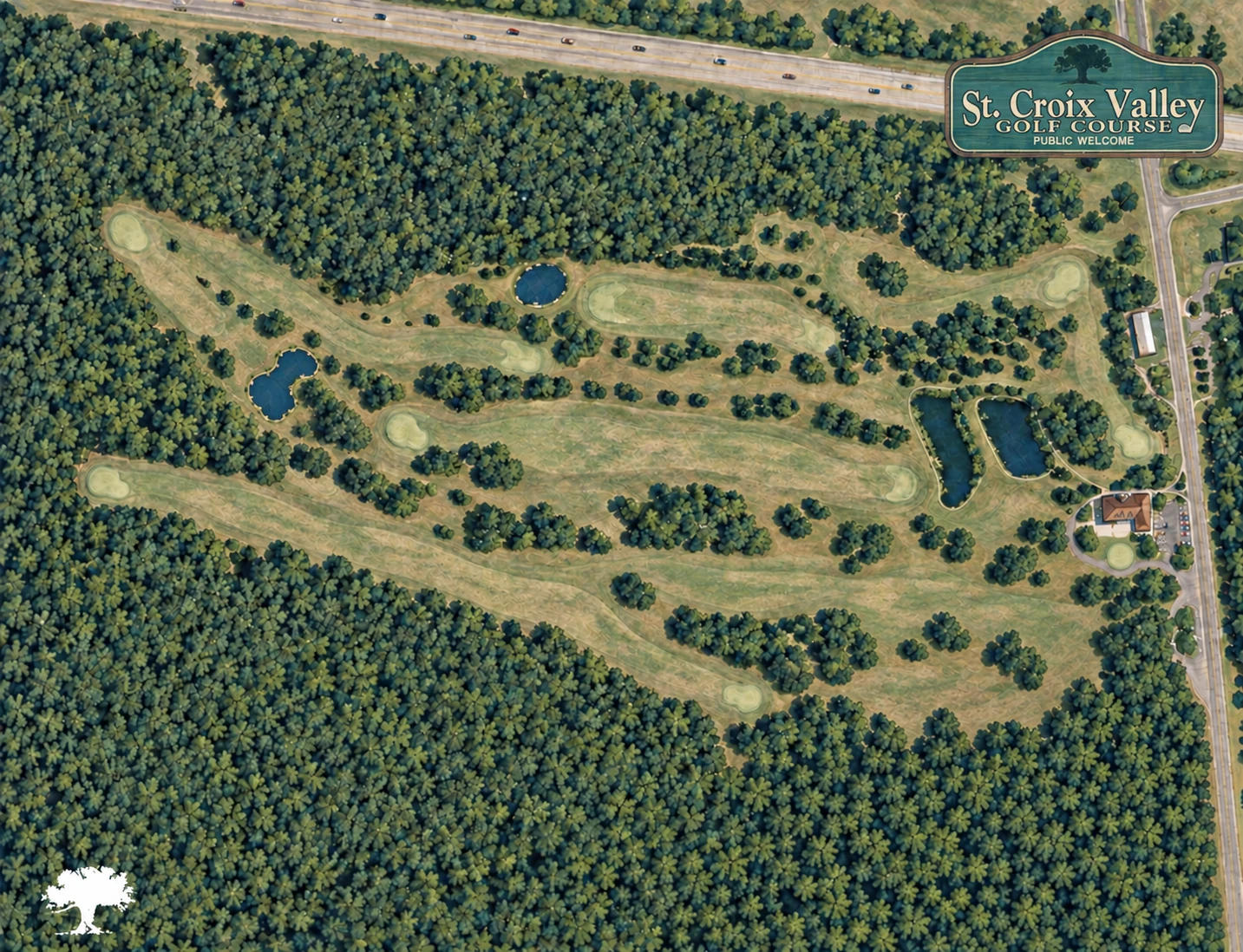
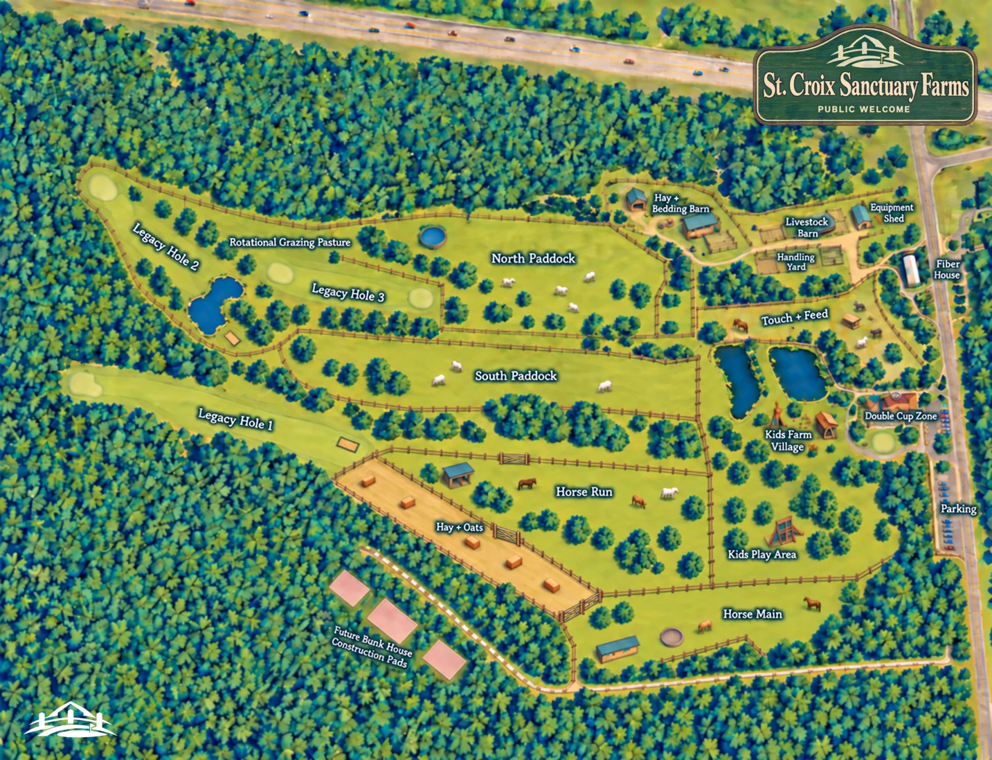
Plate II
How the land is used
All 105.9 acres, accounted for. Most of the ground stays open — pasture, legacy fairways, woodland, water, and buffers — with only a small share given to buildings, the café, and the places people gather.
28.0
15.0
12.0
42.9
0105.9 acres total
The whole property · by zone
| Zone | Acres | Share |
|---|---|---|
| Core farm | 28.0 | 26.4% |
| Three legacy holes | 15.0 | 14.2% |
| Horse precinct | 12.0 | 11.3% |
| Children’s precinct | 5.5 | 5.2% |
| Double Cup Coffee Shop | 2.5 | 2.4% |
| Woodland, water, buffers, circulation, buildings & future pads | 42.9 | 40.5% |
| Total | 105.9 | 100% |
Pasture & production · the grazeable and productive fields
North Paddock9.5 ac
South Paddock9.0 ac
Legacy rotational pasture7.0 ac
Horse Run7.0 ac
Horse Main5.0 ac
Hay + Oats3.5 ac
Touch + Feed1.5 ac
Working fields42.5 ac
These fields sit inside the zones above — mostly within the core farm and horse precinct, with the legacy rotational pasture drawn from the kept fairways. The rest of the acreage is woodland, water, buffers, paths, and buildings.
Digital land model · the digital twin
A digital model of the ground
The illustrated plan could become a living geospatial model of the property: a shared digital layer connecting parcel boundaries, paddocks, slopes, ponds, buffers, infrastructure, soil results, grazing history, and conservation work. As conditions change, the map changes with them.
Technically, this is a digital twin. A geospatial database (for example PostGIS) holds every layer as queryable geometry; a time-series database (for example TimescaleDB) carries the live sensor and weather feeds; and object storage keeps dated drone and satellite imagery. Any question about the property then resolves against current data — not a PDF from last season.
Observe
- Soil chemistry and health
- Rainfall, soil moisture, and water quality
- Vegetation, forage, and exposed ground
- Drainage paths, slopes, and erosion
- Grazing history and pasture recovery
- Fences, shelters, utilities, and maintenance
Model
- Geospatial runoff and erosion risk
- Pasture condition and recovery forecasts
- Buffer and shoreline change
- Intervention opportunities
- Seasonal carrying-capacity scenarios
- Infrastructure and access conflicts
Decide
- Where to sample or inspect
- When to rest or rotate pasture
- Where buffers or swales may help
- Which interventions merit a pilot
- What evidence partners need
- What changes should be documented
Not a static master plan. A shared operating model of the property, updated as the land responds.
Plate IIIThe working fiber farm
A fiber farm raises animals for their fleece — wool from sheep, soft fiber from alpacas. Animals arrive only after the systems that keep them well are in place, and the farm-to-yarn story is meant to be visible — shearing, skirting, and fiber prep where visitors can witness the work.
Animals + fiber
Begin with 8–12 sheep and 3–4 alpacas. Fiber goats are added only after care capacity is proven.
Rotational grazing, quarantine, winter feed, and veterinary systems precede any public encounter with the animals.
Land + water
Center fairways become primary pasture; connected legacy-hole land gives secondary rotation. The lower fairway carries hay and oats.
Prairie, shoreline buffers, pond buffers, and rain gardens support habitat and water stewardship — with an apiary partner working suitable pollinator areas identified through the baseline and farm plan. Dairy and cheesemaking are out of scope.
Buildings + access
A renovated clubhouse, livestock barn, service yard, shelters, and covered feeding area anchor operations; the former cart-storage building is studied as the Fiber House.
Existing cart paths carry farm logistics, walking routes, and guided tours. Three legacy holes stay playable. Kids’ engagement stays beside supervised viewing — never inside working pasture.
Sensing & modeling
Conservation intelligence
Environmental monitoring becomes more useful when separate observations can be read together. The Living Systems Lab could combine field measurements, imagery, weather, and operating history to detect change, test interventions, and help conservation partners understand what is working.
Computer vision
Compare drone, satellite, or fixed-camera imagery to estimate vegetation cover, exposed soil, invasive growth, buffer integrity, pond-edge change, and visible erosion.
Geospatial models
Combine elevation, soils, drainage, rainfall, vegetation, and land use to map runoff risk and identify possible intervention areas.
Time-series models
Follow water quality, soil moisture, pasture recovery, and weather over time to detect trends and forecast changing conditions.
Experimental analysis
Compare conditions before and after managed grazing, native buffers, swales, stabilized crossings, or reduced-input practices to estimate measurable benefit.
The models surface patterns and possibilities. Farmers, engineers, and conservation partners determine the action.
Agentic operations
An operating copilot for FarmCo
FarmCo could use an agentic workflow layer to turn observations, schedules, forecasts, and operating records into an organized daily picture. The system would observe, prioritize, recommend, assign, and document — while leaving care and operating authority with the farm team.
- Build a morning briefing from weather, pasture, livestock, staffing, and maintenance data.
- Recommend grazing rotations using forage condition, stocking history, forecast weather, and recovery intervals.
- Convert field observations or sensor exceptions into assigned inspection tasks.
- Track animal-care routines, quarantine requirements, shearing, and fiber production.
- Forecast hay, bedding, feed, and operating-supply needs.
- Maintain fiber provenance from animal and shearing date through sorting, processing, and finished goods.
- Prepare operating summaries and escalate exceptions to the farm operator.
AI may observe, organize, recommend, and document. Animal treatment, purchasing, equipment operation, and changes to grazing remain human-approved.
The tools the copilot may call are read-and-draft only — query the property model, pull sensor and weather feeds, run a model, retrieve an SOP, and open a draft task or report. It has no tool that writes to a physical control, a purchase, or an animal-care record.
01Sensors, imagery + farm records
02Data validation
03Models detect change
04Agent adds context
05Operator approves action
06Outcome is measured
Example workflow
A NOAA forecast crosses a rainfall threshold. The runoff model recomputes risk from DEM-derived flow paths, current soil-moisture readings, grazing positions, and manure locations, and flags Paddock 7 as elevated (confidence 0.82). A grounded agent retrieves the applicable NRCS setback standard and the paddock’s history, drafts a recommendation to hold the herd and inspect the downstream buffer — citing both sources — and opens a draft task. The farm operator approves; the decision is logged, and later water-quality readings measure whether it made a difference.
The game stays in the ground
Not every fairway becomes pasture. A few legacy holes stay mown and playable — a green, a flag, a walk some families have taken for the better part of a century, and a natural way to bring people (and fundraisers) onto the land early.
Turning a golf course into a farm doesn’t have to mean erasing it. Keeping a little of the game keeps the neighbors, the owners, and the memory with the mission.
Illustrative concept
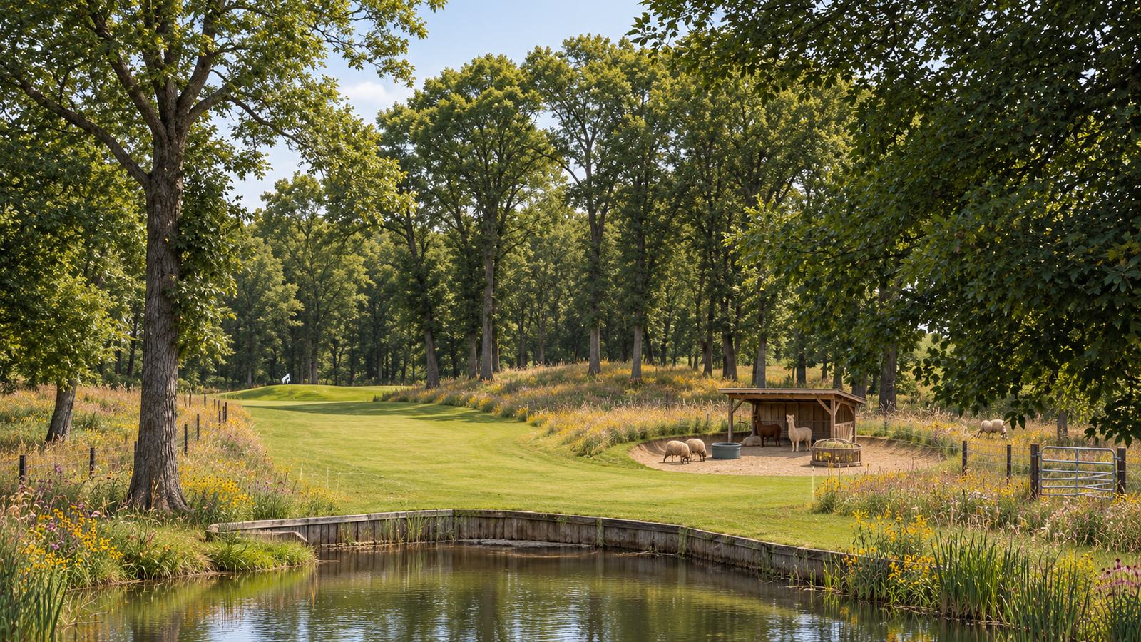
Plate IVDouble Cup Coffee Co. — the front door
The invitation is built to grow with the farm, not ahead of it. A mobile coffee cart is the first threshold — a flexible way for neighbors, volunteers, and early supporters to witness the work before a single wall is renovated.
The coffee-shop kitchen follows as visitor systems, building plans, and an appropriate location are confirmed.
EarlyCart
Double Cup Coffee Cart & TruckA mobile front door — coffee, presence, and a reason to come see the animals. On the land from day one.
LaterShop
Double Cup Coffee ShopA clubhouse walk-up window, focused coffee, hard-scoop ice cream, and supervised family activity — planned after baseline review, siting, and visitor systems are complete.
Illustrative concept
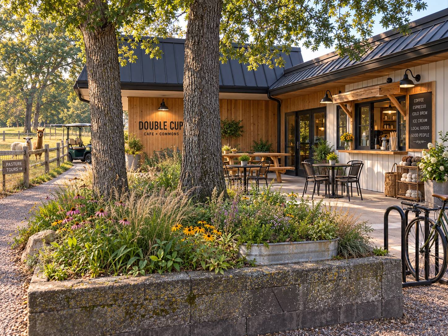
Plate VThe intelligence layer
Quiet operating infrastructure behind the farm — not a separate venture. The Living Systems Lab is how observations could become accountable action across River North Land Co and FarmCo, with people deciding at every step.
System architecture
The intelligence architecture
The Lab connects physical observations to accountable action. Its architecture is designed as a closed learning loop rather than a collection of disconnected AI tools.
1 / Data
2 / Models
3 / Agents
4 / Human decisions
Measured results return to the data layer
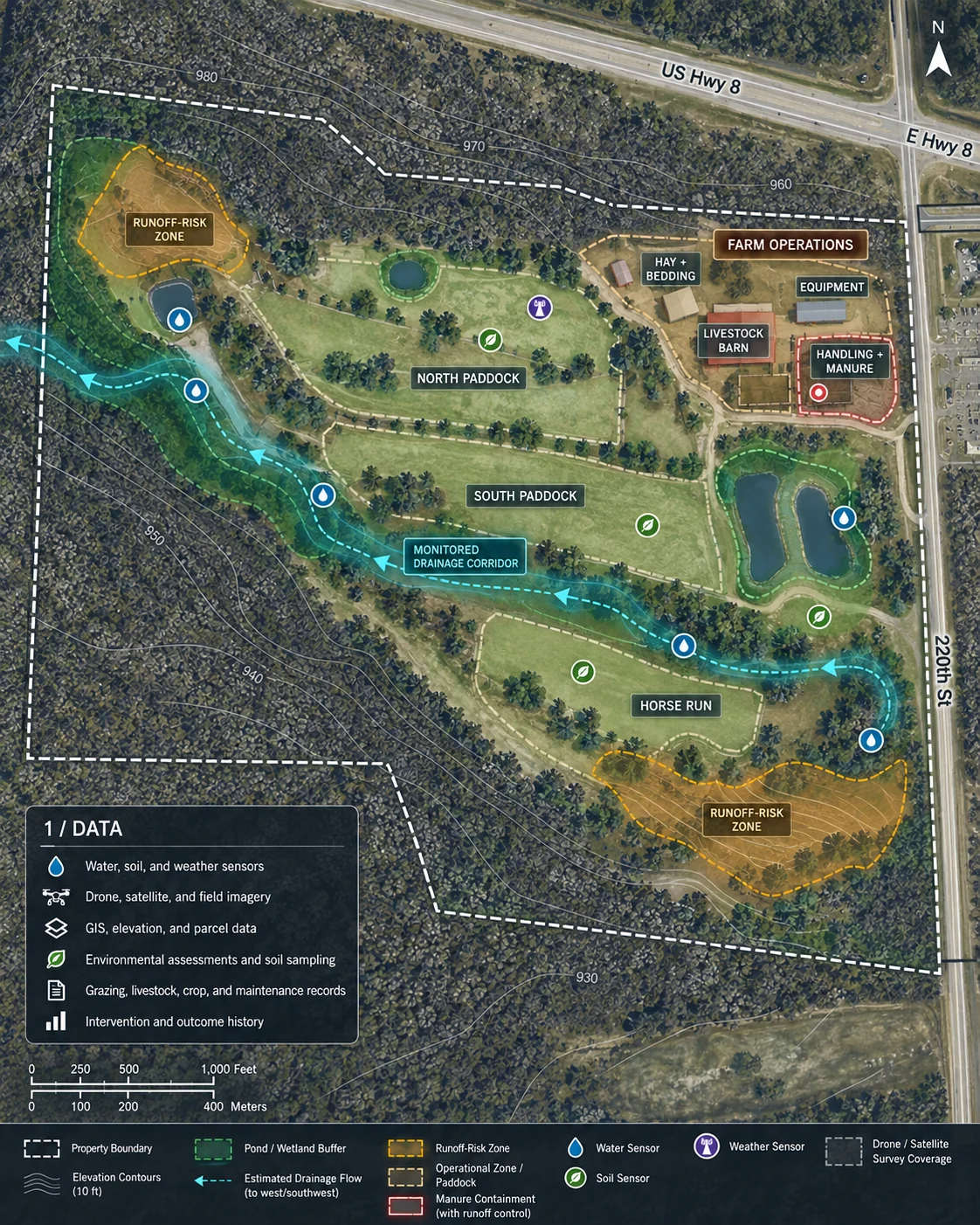
What layer 1 looks like on the groundIllustrative · not live data
Technical field notes — data pipeline, models, retrieval & the evaluation harness
The data pipeline
Each source lands in a store built for its shape: a geospatial database (e.g. PostGIS) as the property’s digital twin, a time-series database (e.g. TimescaleDB) for sensor and weather streams, object storage for dated imagery, and a document store for the knowledge base. Sensors feed continuously, imagery on each flight or satellite pass, records on change. A validation stage runs first — gap and faulty-sensor checks, unit and range tests, and georeferencing — so no model ever infers on bad data.
Models — approaches, not a black box
Most of these are established techniques on standard tooling; the work is integrating and grounding them on this specific property, not inventing new models.
- Computer vision — land-cover / bare-soil segmentation and change detection across image dates (off-the-shelf backbones, fine-tuned on local imagery)
- Geospatial — raster runoff and erosion risk from DEM slope + flow accumulation, soils, and rainfall
- Time-series — water-quality, soil-moisture, and pasture-recovery forecasts with uncertainty bands
- Anomaly detection — outliers in sensor and operations streams
- Optimization — grazing rotation and resource scheduling under constraints
- Language models — synthesis and reporting only, grounded via RAG (below)
Grounded in an approved knowledge base
Retrieval-augmented generation, or RAG, would allow the Lab’s agents to consult approved project records and technical guidance before producing a recommendation or report. Instead of relying only on a general-purpose model, the system retrieves the most relevant sources, uses them as context, and cites them in its output.
The retrieval path
Ingestion → chunking → embeddings → vector store (e.g. pgvector) → semantic retrieval → grounded generation with inline citations. Every recommendation carries source, date, the property data it used, and a confidence score; anything it cannot ground, it declines to assert.
Trusted knowledge sources
- NRCS conservation standards
- UW–Madison Extension guidance
- Conservation easement and partner requirements
- Farm standard operating and emergency procedures
- Veterinarian-approved animal-care protocols
- Soil and environmental assessments
- Permits, maps, engineering documents, and inspections
- Paddock histories and livestock records
- Prior interventions and measured outcomes
- Partner agreements and reporting requirements
Every recommendation should show its source, date, property data, and confidence.
A harness around the intelligence
The harness is the set of tests, permissions, and checkpoints surrounding the models and agents. It determines when the system has enough evidence to make a recommendation, when it must ask for review, and how its performance is audited over time.
Staged autonomy
STAGE 0Shadow. AI recommends into a log; humans work as normal; every recommendation is scored against what they actually did.
STAGE 1Supervised. Recommendations enter the daily workflow; each needs explicit approval; approvals and overrides train the system.
STAGE 2Limited autonomy. Routine drafts auto-generate; still no operational action; higher-stakes items always route to a person.
Standing checks
- Missing, delayed, and faulty-sensor checks
- Model comparisons against verified field observations
- Seasonal back-testing with historical conditions
- Confidence thresholds, calibration, and exception handling
- Source citations for RAG-supported outputs
- Human approval before operational changes
- Complete recommendation, decision, and action logs
- Model-drift and changing-condition monitoring
- A model, prompt, and knowledge-base version registry
- Role-based access for River North Land Co, FarmCo, and partners
Nothing acts directly on animals, land, equipment, or regulated decisions. The system surfaces evidence, recommends action, and records the accountable human decision.
Data governance
Shared intelligence, clear ownership
River North Land Co owns the conservation baseline, easement, watershed, and restoration record. FarmCo owns livestock, grazing, production, staffing, and daily operating data. Each entity controls its own records — while approved data can flow into the Living Systems Lab for shared analysis and reporting. Growing Pastures receives only the information required for education and public-benefit measurement.
Access is role-based per entity. Community participation data is analyzed only as aggregate cohorts, never individual profiles. Deployment posture (managed cloud vs. on-prem) and data residency remain open decisions for the applied-AI systems partner.
No clinical or resident data enters this architecture.
Plate VIThe structure & the numbers
The land, the farm, the mission, and the front door are built as distinct entities by design — so each can be funded, governed, and proven on its own terms, and no one part carries another’s weight. The Living Systems Lab threads through all four as shared infrastructure — detailed in the intelligence-layer plate above.
Holds the land
River North Land Co LandCo
conservation
Owns and protects the ground, and runs all conservation — acquisition pipeline, easements, restoration, and the watershed program. Land capital is raised and held apart from the farm build.
Runs the farm
FarmCo
production
The working fiber operation — livestock, pasture, hay and oats, fiber to yarn. The one entity this capital view is scoped to.
Carries the mission
Growing Pastures Foundation nonprofit
education & community
Education, community programs, volunteering, and public benefit — the reason the farm exists beyond what it produces.
Opens the door
Double Cup Coffee Co.
hospitality
The public welcome — coffee cart, then coffee shop. Its own economics, built and funded on its own line.
How they hold together. River North Land Co stewards the ground and leases it to FarmCo, which does the daily work. Growing Pastures Foundation brings people, education, and purpose onto the land. Double Cup Coffee Shop opens the gate to the public. The future Bunk House is a separate entity and a separate capital decision — deliberately last.
The farm is not a funder. It is the foundation — the ground on which community and purpose are built.
River North Land Co · A living watershed laboratory
The land goes back to work gently — a conservation-led fiber farm and public demonstration property where rotational grazing, restored prairie, crop production, runoff controls, and visitor education coexist. Beyond the farm itself, the property can serve as a real-world test and demonstration site for farm-runoff solutions and land-and-water stewardship:
- 1Establish a baseline — soil, vegetation, drainage, and water-quality conditions.
- 2Pilot practical interventions — managed grazing, native buffers, swales, stabilized crossings, manure controls, and reduced-input crop systems.
- 3Measure outcomes with credible technical partners.
- 4Host field days and public interpretation.
- 5Publish an approved case study that other landowners and commercial solution providers can use.
Two capital envelopes, funded in sequence
The money arrives in two separate pools, raised and accounted for apart from each other. The first secures the ground and gets to know it well enough to farm; the second builds the farm — and it is only committed once the first is complete. The land purchase itself sits outside both, carried by the conservation pipeline.
Envelope A · River North Land Co · pre-acquisition
Securing the land — option & diligence
Before any purchase closes, an exclusive option or extended purchase agreement holds the property while Sanctuary Farms funds the appraisal, survey, environmental review, title work, water assessment, and land-use diligence — with soil and water testing at its center, so the plan rests on a clear picture of the ground. The owners keep control through this window and receive additional consideration if it is extended. This same baseline testing seeds the watershed laboratory’s first measurements. The land purchase price is carried by the conservation pipeline; this envelope is only the runway to a confident, well-informed decision.
$125–350K
Pre-acquisition diligence & baseline testing — order-of-magnitude for ~106 acres.
Runway first
Held entirely apart from the FarmCo build, and spent before it.
Diligence & testing — line by line
- Appraisal · complex / special-use
- $10–20K
- ALTA survey + topography · ~106 ac
- $12–30K
- Environmental site assessment
- $3–6K
- Soil & groundwater testing · sampling across the historic course
- $25–75K
- Agronomic + soil-health testing · suitability mapping
- $15–40K
- Water assessment · wells, rights, shoreline + baseline sampling
- $10–25K
- Title, legal + entity formation · option & purchase agreements
- $15–35K
- Land-use, zoning + entitlement feasibility
- $8–20K
- Option consideration to owners
- $10–40K
- Diligence management + contingency
- $15–60K
- Pre-acquisition total
- $125–350K
Order-of-magnitude planning ranges for a ~106-acre former golf course, each line buffered. The testing range allows for representative coverage across land used as a course since the 1920s, including appropriate consideration of possible legacy turf-management chemicals. Findings would inform siting and stewardship plans. The land purchase itself is separate. Figures would be confirmed by qualified appraisal, environmental, legal, and lending professionals before any commitment.
Envelope B · FarmCo · Year 1
Establishing the working farm
In scope — farm capex (FarmCo)
- Farm buildings & livestock facilities
- Pasture conversion, water & runoff (redevelopment)
- Vehicles & major equipment
- Opening livestock, supplies & reserves
Held apart — not in this number
- Land acquisition — carried by the conservation pipeline
- Option + pre-acquisition diligence — Envelope A, above
- The future Bunk House — a separate, later decision
- Double Cup Coffee Shop — built and funded on its own line
- Growing Pastures Foundation — nonprofit startup & programs
$1.9–2.5M
Year 1 farm establishment — a buffered planning range for FarmCo.
Land, apart
The cost of the ground runs through conservation, off the farm books.
Farm ≠ funder
The farm is the foundation for community and purpose — not the thing that pays for the rest.
Year 1 farm capex — line by line
- Planning, design + engineering
- $110–160K
- Licensing, permits + farm approvals
- $60–110K
- Buildings + livestock facilities
- $750–900K
- Pasture conversion, water + runoff · redevelopment
- $480–620K
- Vehicles + major equipment
- $180–250K
- Opening livestock + supplies
- $40–70K
- Construction contingency
- $180–260K
- Pre-opening operating reserve
- $90–140K
- Farm establishment total
- $1.89–2.51M
Farm establishment only — order-of-magnitude planning ranges, each line carrying its own buffer, with construction contingency on top. Farm maturity (visitor-safe systems, expanded livestock, and equipment) is a later, separately-scoped farm investment. Land, the pre-acquisition diligence (Envelope A, above), the Bunk House, and Growing Pastures Foundation sit outside this figure, and Double Cup Coffee Shop is built and funded on its own line — none counted here.
Monitoring, connectivity + data systems Partner-scoped · TBD after baseline design
Baseline instrumentation, water and weather sensors, field connectivity, imagery, farm-management software, integrations, dashboards, and early model development form a distinct enabling layer. Final scope and cost would follow the baseline study and partner architecture.
Plate VIIA legacy partnership
A legacy partnership, not simply a sale. The property can transfer in a way that protects the owners’ financial interests while creating room for long-term stewardship. Rather than depend on a single funding source, the acquisition could combine an independently appraised purchase, meaningful cash at closing, a secured seller note, and, only if the owners choose, a qualified conservation or charitable component.
01 /
Secure the runway
An exclusive option or extended purchase agreement would establish clear milestones while Sanctuary Farms funds the appraisal, survey, environmental review, title work, water assessment, and land-use diligence. The owners retain control during this period and receive additional consideration if the closing window is extended. Costed as Envelope A in Plate VI.
02 /
Blend forms of value
Cash at closing could be combined with an interest-bearing seller note, providing immediate liquidity and dependable income over time. Conservation funding could increase the cash available at closing. A bargain sale or conservation-easement donation could also offer tax-planning potential, but only if the owners elect it and the charitable interest is received by a qualified nonprofit or public entity.
03 /
Carry the legacy forward
A conservation easement could protect the watershed, pastures, tree corridors, and open landscape while preserving a surveyed development envelope for buildings, roads, utilities, farm infrastructure, Double Cup Coffee Co., Growing Pastures Foundation, and future mission uses. The owners could also choose to be recognized as founding land partners — through a named trail, overlook, pasture, or permanent account of the property’s history.
For the owners
Fair-value process · cash at closing · secured income · optional tax and legacy pathways
For Sanctuary Farms
Time to assemble capital · lower immediate debt · unified land protection · more resources for restoration
The final structure would be developed collaboratively with the owners and reviewed by qualified Wisconsin legal, tax, appraisal, lending, and conservation professionals. No charitable treatment or permanent land restriction would be assumed in advance.
Plate VIIIThe mission & what comes next
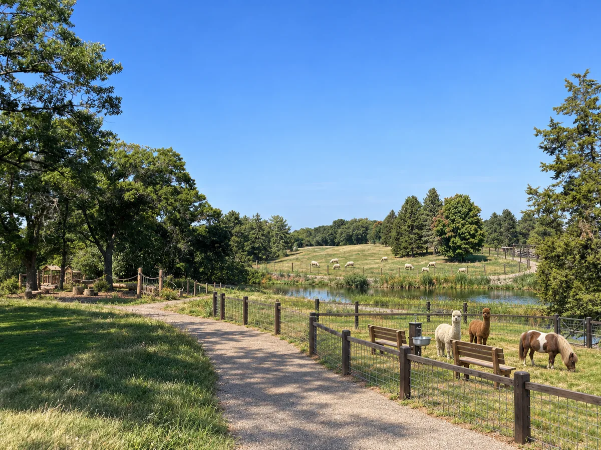
Illustrative rendering
Growing Pastures Foundation
The nonprofit that carries the purpose.
Daily work on a real farm is the teacher. The Foundation turns it into hands-on education, school and group programs, volunteer and service pathways, and fiber-arts learning — all on an open public commons where neighbors gather.
Service and belonging are the point. This is where the farm earns its meaning: a foundation for community and purpose, not a funder of it.
- Education & school-group programs on a working farm
- Volunteer & service pathways for neighbors and partners
- Fiber arts, animal care & farm skills
- A public commons for gathering, markets & seasonal days
A future chapter — excluded from this plan
The Bunk House
Someday, once the farm’s rhythm and community are real — and the ground is proven whole — a small residential place could grow here: a restorative, low-acuity stay for people in the “missing middle” between everyday support and the hospital.
Voluntary, humane, and modest in scale. Not a hospital, not a crisis unit, not locked care — a place to steady, do good work, and return to ordinary life.
Deliberately last: welcomed only after the farm, the mission, and the community are real. A separate entity and a separate capital decision — held apart from everything above.
Plate IXHands we’re looking for
The project turns planning questions into partnerships before it turns them into buildings. If one of these is yours, this is the conversation to have.
Farm operatorBudget, staffing, production, and daily systems
Sheep + alpaca mentorsBreeds, handling, welfare, shearing, and fiber
Veterinarian + nutritionistHerd health, quarantine, and feed plans
Crop / forage partnerPasture, hay, oats, and custom harvesting
Watershed teamCivil engineer, NRCS / UW-Extension, conservation
Conservation partnerEasement, acquisition pipeline, and land stewardship
Environmental consultantSite assessment, baseline characterization, and stewardship planning
Apiary partnerBeez Kneez and the wider St. Croix bee community
Double Cup operatorCart, coffee shop, food licensing, hospitality economics
Foundation leadershipGrowing Pastures Foundation — programs, education, volunteers
BH / SUD recovery networkBehavioral-health & substance-use recovery community and referrals
Capital + philanthropyGovernance, campaign, and access-fund partners
Research + data partnerStudy design, baseline definition, geospatial analysis, outcome measurement, and publication
Applied AI systems partnerSensor integration, data architecture, models, agent workflows, RAG, evaluation harnesses, and responsible deployment
The invitation
A dream is only worth building if it’s shared
The Farm of Dreams sets out to do something quietly ambitious: carry forward a landscape people love, put it back to purposeful work, and grow a place where community, education, and purpose take root — with a restorative home for the missing middle someday at its center.
Building it is a monumental effort. But what would dreams be if they weren’t shared? This is an open hand to the people who could help make it real — owners, farmers, conservationists, educators, and neighbors who want to see this ground live again. If one of those hands is yours — or you’d simply like to walk the land — that’s the conversation to start.
Ryan Corcoran
Concept origin & development · Kernel Collaborative
ryan-corcoran.com
The full concept workspace — visual library, land, farm, funding, and market pages — is available to partners on request.